


GPS Navigation:Street View Map
0.00.00 Reviews
App Specs
- Version
- 2.7
- Updated On
- License
- Free
- Downloads
- 10,000+
- Developer
- Technest Apps
- Categories
- Maps & Navigation
- Platform
- Android
Screenshots
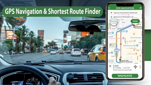
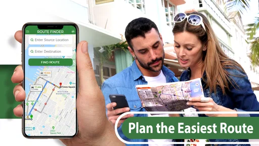
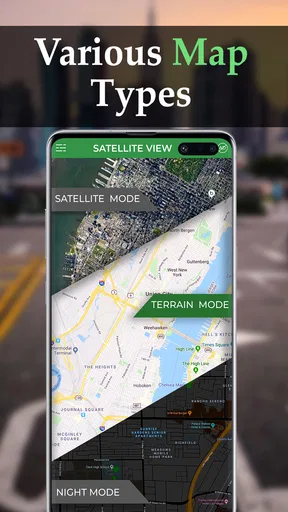
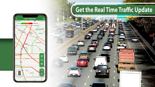

 Analysis by AppCompare
I tested GPS Navigation:Street View Map as a practical travel companion rather than treating it as just another map icon. It is a free Android navigation app from Technest Apps, aimed at people who want directions, map browsing, and street-level visual context in one place. That combination sounds simple, but it changes how useful the app feels: I could move from planning a route to checking what the surrounding streets look like before deciding where to go.
The app is listed in the Maps & Navigation category, carries an Everyone age rating, and works on Android 9 or later. It has passed the early trial stage with over ten thousand installs, while version 2.7 is the current release. The basic download is free, although optional in-app purchases range from about three dollars to fifty dollars per item. I would not approach it as a guaranteed replacement for every established navigation service. Instead, I see it as a focused option for users who value visual orientation and a straightforward route-finding workflow.
From an unfamiliar address to a usable travel plan
I find the most useful starting point is the moment before a trip, when an unfamiliar address is still just text and I need to turn it into a place I can recognize. I’ll look at how checking the surrounding streets can shape a more confident plan, then consider what makes that preparation practical rather than just another map-browsing detour.
Starting with the real problem: knowing where you are going
My most useful test began with a familiar everyday situation: I had an address for a destination but did not know what the final approach would look like. A written address can tell me where to go, yet it does not always answer the questions that cause stress in real life. Is the destination on a busy road? Does the entrance appear to face a side street? Will I recognize the area when I arrive?
This is where the app’s combination of GPS directions and street-view-style map exploration makes sense. I could start with the destination as a normal navigation task, then use the map to build a visual impression of the surrounding area. That extra step is more useful before leaving than after I have already missed a turn.
The experience is best for a user who wants to prepare, not only react. If I am visiting a clinic, apartment building, shop, or meeting point in an unfamiliar neighborhood, looking around the destination first can reduce the number of decisions I need to make while moving. The app does not turn an unknown place into a familiar one instantly, but it gives me a better mental picture than a bare address does.
Entering a destination and reading the map
The first handoff is from my intention to the map: I provide a place to search for, and the app turns that request into a location I can inspect. At this point, I pay attention to whether the selected result is actually the place I mean. Similar names, nearby roads, and businesses with more than one branch can all create trouble in any mapping app, so I do not start moving until the pin and surrounding streets look plausible.
Worth Reading Before You Choose

Flipboard Shows What News Apps Must Do Beyond the Feed

Switching to Android Auto Means Rethinking Your Driving Routine

Google Calendar Makes a Crowded Week Easier to Manage

Ludo King Makes the Most of the Minutes Between Plans

Baby Panda World Brings Quick Play to Modern Phones, but Its Game Library Feels Busy

ESPN’s Live Game View Makes Following Close Games Easier
That small verification habit is one of my strongest recommendations. Before following directions, zoom out far enough to understand the neighborhood, then zoom back in to inspect the final approach. A route can be technically correct while still leaving me unsure about the last few meters. Checking both scales helps connect the route line with the real street layout.
The map view is also useful when I am not ready to navigate. I can use it as a planning surface: identify the general area, see how the destination relates to nearby roads, and decide whether I need a closer look at the street environment. This makes the app more than a turn-by-turn starting button, even though the navigation function remains its main purpose.
Using visual context before following the route
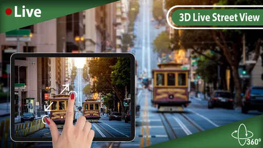
The street-view element is the most distinctive part of the workflow. Instead of trusting only a colored route line, I can inspect the destination area visually. For me, this is particularly helpful when the address is in a dense neighborhood, when entrances are not obvious, or when I am meeting someone near a landmark rather than at a clearly marked storefront.
I would use this feature in a specific order. First, I would locate the destination. Next, I would inspect the nearby roads and intersections. Finally, I would compare the visual clues with the written destination details I already have. This prevents the street imagery from becoming an entertaining detour and keeps it connected to an actual travel decision.
There is a subtle trade-off here. Street-level imagery can improve confidence, but it should not be treated as a live view of current conditions. Buildings, signs, road layouts, and temporary access arrangements can change. I found the visual layer most valuable for orientation and recognition, not for assuming that every detail will look exactly the same when I arrive.
Moving from preparation to navigation
The next handoff is from browsing to action. Once I have checked the destination, I can use the route guidance as the active part of the trip. This separation between preparation and movement is important because it lets me do the careful visual work while stationary. I would rather examine an unfamiliar junction before leaving than try to interpret every detail while walking or riding.
For a short urban trip, the app can fit naturally into a simple routine: search for the destination, inspect the final streets, begin directions, and use the map as a reference while moving. For a longer journey, I would spend more time checking the route before departure and would keep a backup plan in mind. The app is more convincing as a practical aid when I use it deliberately, rather than expecting it to remove every uncertainty automatically.
One non-obvious benefit is that the preparation stage can help with handoffs between people. If I am sending a destination to a friend, describing a meeting point, or explaining where an entrance sits relative to a road, a visual map can make the conversation clearer. I can refer to a recognizable corner or approach instead of repeating an address that may mean little to someone unfamiliar with the area.
What the workflow feels like during an everyday trip
Imagine that I am heading to a new restaurant after work. I search for it, confirm that the selected location matches the expected neighborhood, and inspect the nearby streets. If the restaurant sits inside a busy block, I look for the likely approach and note nearby landmarks. I then start directions and keep the map available as I travel.
When I get close, the earlier visual check becomes useful. I am not searching from scratch; I already have an idea of what the surroundings should look like. If the entrance is not immediately obvious, I can compare the road layout and nearby buildings with the picture I formed during preparation. That is a realistic advantage over using a route line alone.
The same workflow applies to a job interview, a school appointment, a delivery address, or a hotel in an unfamiliar district. The app is not necessarily changing the journey itself. It is reducing the gap between a location on a screen and the place I need to recognize in person.
Where handoffs create friction
Every navigation app has handoffs where errors can appear: search becomes a selected place, a selected place becomes a route, a route becomes movement, and movement becomes arrival. I found that the most important handoff to supervise is the first one. If the wrong result is selected, polished directions will not fix the original mistake.
The next friction point is switching between map information and street-level context. Visual exploration is valuable, but it can also tempt me to keep browsing after I already have enough information. My best approach is to set a purpose for the inspection: confirm the final turn, identify the entrance area, or understand the nearby landmark. Once that question is answered, I return to the route.
Another practical limitation is that I would not rely on this app alone for a high-pressure trip where I need extensive transport planning, detailed live traffic intelligence, or a broad ecosystem of saved places and connected services. Those needs may be handled better by a larger, more established navigation platform. GPS Navigation:Street View Map feels more focused, and that focus is both its appeal and its boundary.
Who will appreciate the app most
I think the strongest audience is made up of casual travelers, pedestrians, visitors, and Android users who want a clear way to combine route planning with visual checking. It is especially suitable for someone who often knows the destination name but feels uncertain about the surrounding streets. The free entry point makes it easy to try without committing to a subscription.
It can also suit people who prefer to prepare a route before leaving. A quick look at the destination area may be enough to avoid confusion at the end of a trip. For a person who regularly visits unfamiliar offices, shops, campuses, or residential streets, that preparation habit can be more valuable than another collection of advanced settings.
I would be more cautious about recommending it to power users who expect a complete navigation ecosystem. If your routine depends on sophisticated route alternatives, detailed transit planning, extensive offline preparation, or deeply integrated travel tools, you may prefer a mainstream mapping service built around those priorities. This app should be judged on its map-and-visual-navigation workflow, not on features outside that core.
Free access and the purchase decision
The app is free to install, which lowers the risk of testing it on an ordinary trip. Optional purchases are listed at roughly $2.99 to $49.99 per item, so I would look carefully at what any paid option changes before buying. The wide range suggests that the purchase decision deserves attention rather than an automatic tap.
My advice is to use the free experience for a complete, low-stakes workflow first. Search for a destination, inspect the area, follow a short route, and decide whether the app’s presentation suits you. Only after that would I consider an in-app purchase. A paid upgrade is worthwhile only if it solves a specific problem in my own routine; it should not be assumed to improve every part of navigation.
How it compares with familiar alternatives
Compared with a standard map application, the clearest reason to choose this one is the emphasis on moving between directions and street-level visual context. Many people already have access to a general-purpose map tool, so the question is not whether this app can show a route. The question is whether its visual orientation workflow feels more useful for the way you travel.
A larger alternative may offer broader place information, more mature traffic tools, stronger public-transport coverage, or a more developed account ecosystem. In exchange, it may feel busier when all I want is to check a destination and understand the final approach. GPS Navigation:Street View Map is appealing when simplicity and visual preparation matter more than having every travel service in one application.
I would also distinguish it from dedicated street-view browsing. A purely visual exploration tool may be better when I want to wander through an area without planning a trip. This app makes more sense when the visual check is connected to reaching a destination. That connection keeps the feature practical, provided I do not confuse imagery with real-time conditions.
Practical habits that make the app more useful
My first tip is to inspect the destination before starting the journey, especially when the final address is in a crowded area. The second is to verify the selected place at two map scales. The wider view confirms the neighborhood; the closer view helps with the final road and entrance. These steps take little effort but reduce avoidable mistakes.
My third tip is to use street-level context for recognition rather than prediction. Look for stable visual relationships such as the shape of an intersection, the position of a large building, or the way a road bends. Avoid depending on details that may change, such as temporary signs, parked vehicles, or storefront displays.
A fourth useful habit is to separate planning from active movement. I would complete the visual inspection before walking, driving, or cycling. That creates a cleaner handoff from preparation to navigation and reduces the temptation to study the map while attention should be on the surroundings.
Finally, I would keep the app’s role proportional to the trip. For a simple visit across town, it can be a convenient all-in-one aid. For a complex journey involving several transport modes, changing conditions, or strict arrival timing, I would pair it with another trusted source rather than expecting one focused app to cover every possibility.
My final assessment after following the complete workflow
After using it from destination search through visual preparation and route following, I see GPS Navigation:Street View Map as a useful, focused Android app for people who want more context than a direction arrow provides. Its strongest idea is not simply displaying roads. It is letting me connect the route with the place I am expected to recognize when I arrive.
The experience works best when I take a few moments to verify the destination and inspect the final approach. That preparation is where the app earns its place, particularly for unfamiliar neighborhoods and hard-to-identify entrances. The workflow is less compelling for users who already rely on a feature-rich navigation platform and rarely need street-level orientation.
Technest Apps has kept the concept approachable: free access, an Everyone rating, and a clear focus on maps, directions, and visual location awareness. I would recommend trying it for ordinary, low-risk trips before deciding whether the optional purchases belong in your routine. My honest recommendation is to use it as a visual planning companion first and a complete replacement for every navigation tool only if your needs are modest.
For me, the final result is a calmer arrival. I still need to check the destination carefully, stay alert to changing conditions, and understand the limits of map imagery. But when the problem is “I know the address, yet I do not know what the place will look like,” this app offers a sensible bridge between those two points.
Pros
- Clear turn-by-turn directions for everyday driving
- Street View helps preview unfamiliar roads and locations
- Useful map search for nearby places and businesses
- Supports route planning before starting a trip
- Simple interface is easy for most users to understand
Cons
- Some features may require an internet connection
- Location accuracy can vary in areas with weak GPS signals
- Map and Street View data may be outdated in some places
- Background GPS use can noticeably reduce battery life
- Advertising or in-app purchases may interrupt the experience
FAQs for GPS Navigation:Street View Map
What is GPS Navigation:Street View Map used for?
GPS Navigation:Street View Map is designed to help users plan routes, find locations, and explore places through map-based navigation and street-view imagery. During testing, it was most useful for checking an area before traveling, viewing nearby roads, and getting a general idea of surroundings. It should be treated as a navigation aid rather than a complete replacement for road signs or local directions.
Does GPS Navigation:Street View Map provide turn-by-turn navigation?
The app may offer route guidance and location-based navigation features, depending on the device, region, and version installed. Before relying on it for a journey, users should confirm that voice instructions, live traffic information, and route recalculation are available in their area. GPS accuracy can also vary indoors, in tunnels, or near tall buildings, so keeping an alternative navigation option is recommended.
Does the app require an internet connection?
An internet connection is generally needed for loading maps, satellite or street-view imagery, searching for places, and receiving updated route information. GPS can identify your approximate position without mobile data, but map content may not appear correctly if it has not been cached. Travelers should check connectivity requirements and prepare important routes in advance, especially when visiting areas with weak reception.
Is GPS Navigation:Street View Map free to download and use?
The application may be available as a free download, but some features can include advertisements, optional purchases, subscriptions, or limitations in the free version. Pricing and available tools can change according to the platform and country. We recommend reviewing the app-store listing carefully before installing and checking whether advanced map functions, navigation options, or an ad-free experience require payment.
What permissions and privacy considerations should users know about?
Because it is a location-focused application, GPS Navigation:Street View Map may request access to your device location, internet connection, and possibly other functions needed to display maps or provide navigation. Grant only the permissions that are necessary for the features you intend to use. Before creating an account or enabling personalized services, review the privacy policy to understand how location and search data may be handled.


